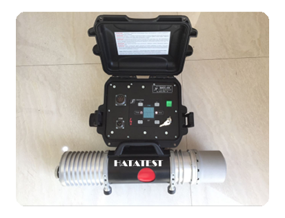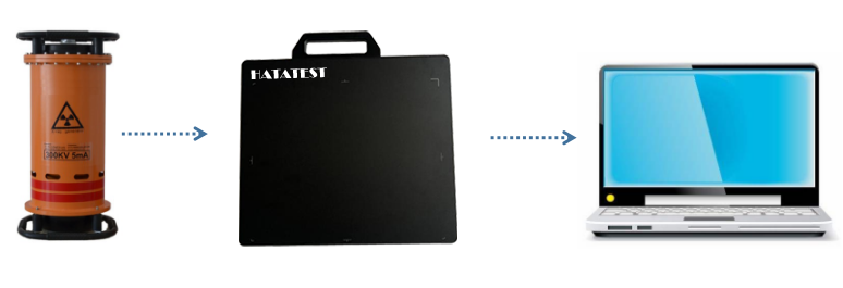
Gas-insulated combined electrical appliances (referred to as GIS) are widely used in high-voltage power transmission and transformation systems. They play a vital role in the power system. Once they fail, the losses are serious. With the continuous development of non-destructive testing methods, non-contact non-destructive testing of GIS equipment by X-ray is an effective external diagnostic method to ensure that GIS equipment is not broken compared with the traditional method of measuring physical and chemical parameters of sensors. Safe and reliable operation in the case of dismantling. The method for detecting the digital X-ray imaging system utilizes a high-frequency X-ray machine and a flat panel detector to transmit the substation gas-insulated combined electrical equipment, and then transmits the detected image to the computer, and the computer intelligent processing method is used as the GIS equipment. The image detection improves the objective basis.
Therefore, some problems in the acquisition of image intelligent processing methods for portable digital X-ray imaging systems are studied, and in-depth research is carried out in the following aspects:
(1) Realizing the perception of high-dimensional space by using non-correlated observation data of industrial X-ray images in low-dimensional space, which is not only an important scientific problem in the theory of compressed sensing optimization, but also an X-ray high-resolution display under the constraints of sensor hardware conditions. A major problem. The isotopic qualifier (RIP) of sparsity and sparse transform is studied under 1-norm. The X-ray image is mapped to the sparse domain by discrete wavelet transform, and the stochastic measurement with the largest uncorrelated rank is established. The machine array is Φ, and the original image is reconstructed by orthogonal tracking matching algorithm under this basis, and the effectiveness of the algorithm in time and effect is proved by experiments.
(2) Due to the influence of the X-ray detector hardware system error, the salient feature information of the image is not clearly reflected. An adaptive dual-platform multi-scale correction histogram is proposed to enhance the salient feature information. Firstly, the initial block of the image is completed by the gray limit function of the contrast-constrained adaptive histogram equalization structure, and then the three-scale factor is projected according to the transform function coefficient, and the scale coefficient is automatically adjusted by referring to the local sub-graph contrast, thereby realizing the transformation. The adjustment of the function. In this method, the contrast is adjusted from the whole and the local aspects, and the gray limit function is selected from the global perspective, and the significant feature details are retained locally.
(3) For the system scanning noise in X-ray images, a method of bivariate non-local fuzzy averaging filtering to remove significant feature information is proposed. The gradient operator is used to reduce the influence of the correlation between adjacent pixels on the overall sample. The fuzzy window is used to set the size of the filtering window and the number of blocks. Then the adaptive non-local averaging processing is applied to the sub-blocks to effectively eliminate the non-significant feature information in the image. Impact.
(4) For the problem that the portable X-ray detector can not complete the primary imaging of large-scale GIS equipment, it is proposed to use the position of the mobile X-ray detector to obtain multiple X-ray image groups of the segmentation, and the maximum cross-correlation based on particle swarm optimization The mutual information determines the potential splicing area, and then the LLE-SIFT fine detection method based on nonlinear manifold dimensionality reduction is used to determine the best matching feature points, and the gradual weighted image fusion method is adopted for the coincident part to realize the coincidence. Natural transitions to obtain GIS images with large viewing angles.
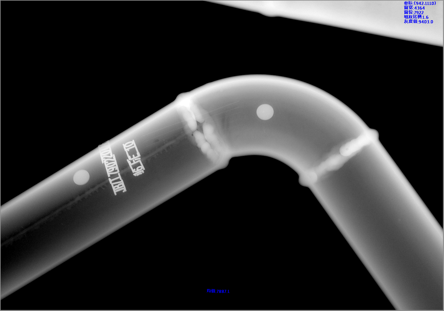
(5) Aiming at the typical defects of GIS equipment, an invariant moment detection based on background restoration of fast neighborhood consistency matching model is proposed. The fast neighborhood consistency matching background model is an improvement of the fast matching repair FMM model, and the single layer point repairing module is evolved into a point and area double repair, which improves the convergence speed of the repair function. In order to improve the accuracy of detection, a method based on digital subtraction of X-ray image containing second-order invariant moment features of GIS contour information is proposed to detect defect types and fault locations in X-ray images, and to eliminate GIS equipment. Security risks in the middle.
-
 Sales@hata-ndt.com
 -
 +86 371 63217179